Scotland is famous for many things (think Whisky, swearing, and Trainspotting), and the Munros are right up there with the best of them.
A Munro is defined by it's height, having to be more than 3000ft (914 meters) above sea level, and there are 282 of them in Scotland. I'm aiming to climb the top 20 at least, and as many of the more interesting ones as I can identify and get to...
Find out more about the ones I've conquered below.
Munros: Broad Cairn / Cairn Bannoch / Càrn an t-Sagairt Mor / Càrn a' Choire Bhòidheach / Lochnagar
Height: 998 meters / 1012 meters / 1047 meters / 1118 meters / 1155 meters
Date: 17/08/2024
Much like when I first completed Lochnagar back in 2019, the decision to challenge the White Mounth Munros was pretty last minute, having a weekend free for camping and no firm plans on where to go.
So late on Friday evening I jumped in the car and drove through to Loch Muick, arriving just after 20h30. Although I was prepared for camping, I took a risk and trudged down the road to the Glas Allt shiel bothy, towards the West end of the Loch. Happily there were spaces free, and I spend a pretty comfortable night there before setting out on my mammoth hike at 8am on Saturday.
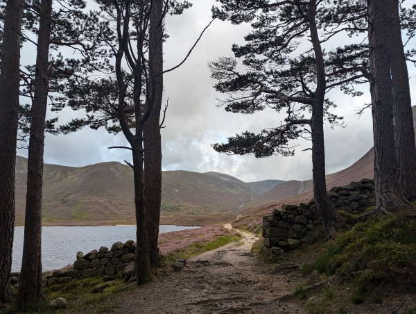
The traditional White Mounth route would start at the car park, and challenge Lochnagar first, before coming down at the top end of the loch and having to walk a considerable length along the loch back to the car park.
Staying at the bothy meant I was able to start the route in reverse, challenging Broad Cairn first, and not having the final trek back, as the circuit came down to the bothy again past Glas Allt waterfall.
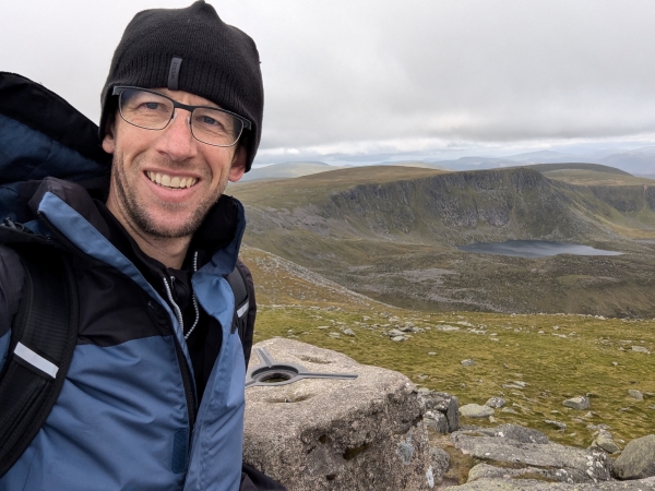
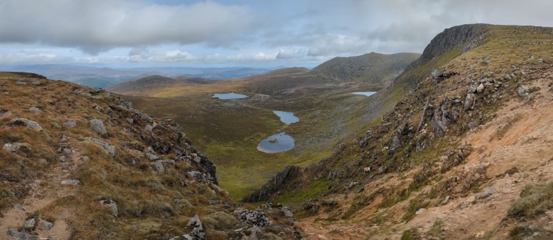
The first part of the hike, up the mountain from the West end of the Loch, provides spectacular views looking back East, and once you hit the escarpment the views to the West and South are breathtaking. Once you've conquered the initial incline (which took me about an hour from the bothy), the individual peaks are actually quite easy, with only small inclines and declines required to conquer them.
Broad Cairn is marked by a ring of boulders towards the top, Cairn Bannoch has even less to make it stand out from the crowd, and the other two Munros, while taller, are almost footnotes on the way to Lochnagar; truly the most breathtaking mountain in the region.
On a cloudy day it's hard to conceive of the true majesty of Lochnagar; such was my experience in 2019, when a thick mist obscured the mountain and surrounds for the majority of the hike. Luckily, on this occasion, I had no such blinders - the mountain was visible in all its glory; skirted by steep cliffs and surrounded by deep valleys, it absolutely dominates the region, and the view from the top is second to none.
The route down from Lochnagar back to the Royal outhouse is a straight shot, and I recommend taking a break at the waterfall to rest your tired feet and relax in the cool mist spraying down the gorge.
As a final note, I had intended to spend a second night at the bothy, but the weather had improved so much throughout the day that by the early afternoon there was no wind down by the Loch, and the Midgies were out in serious force. Not being willing to be eaten alive, I packed my goods and, sore feet, knees & hips notwithstanding, trekked back to the car, with only several dozen bites to show for it!
You can read more detail on the route, and download Offline maps on the Walkhighlands website.
Munros: Ben Wyvis
Height: 1046 meters
Date: 01/06/2024
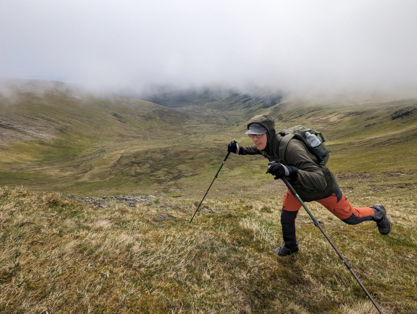
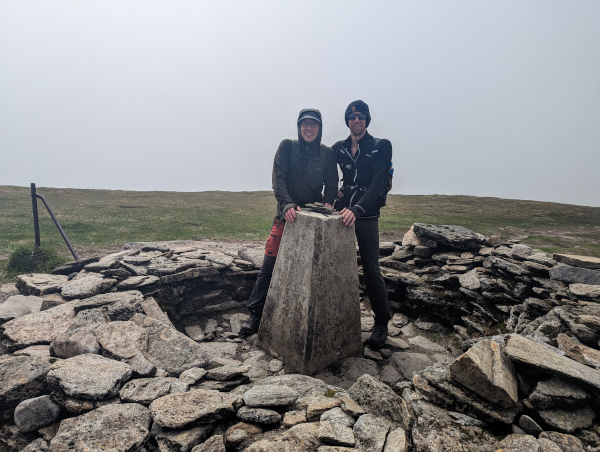
Ben Wyvis was mine and Lukasz K's first munro of 2024, and boy did we feel it! It's been a long Winter, and we were both pretty out of shape, meaning the first stretch especially, even though it was pretty flat, was really tough going!
That said, by the time we were half way up the mountain, I was feeling more alive and happy than I had in months.
Now, what to say about Ben Wyvis itself? Well, for starters, it's a pretty isolated Munro, meaning it towers above anything in the near vicinity, and as a result affords some of the best views to the West & South as you're ascending its West face. We counted up to 15 Munro's visible to the West, and another 10-15 when looking South. On a clear day, you can see all the way to the Ullapool and the West Coast.
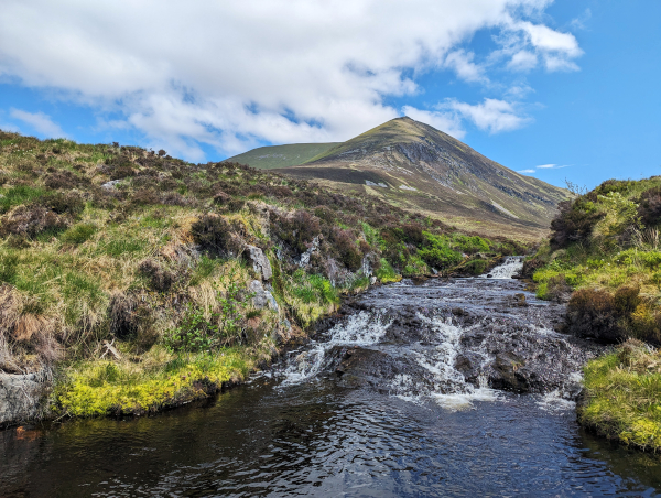
Speaking of Clear days, we had a beauty! It was prefectly still down at the car park, and manageably windy by the time we reached the ridge leading across to the summit. We also had pretty clear sky till we reached the top, though it was quite cloudy at the summit until we were heading back.
This is a straight up and down route, so once you've hit the summit, turn around head back the way you came. There's a spot along the stream where you can stop and rest you're weary feet in the fresh cold water too.
You can read more detail on the route, and download Offline maps on the Walkhighlands website.
Munros: Mayar / Driesh
Height: 929 meters / 948 meters
Date: 13/05/2023
Before this was organised as a fun work event, I would never have considered climbing Mayar or Driesh, as they're definitely towards the lower end of the Munro classification list, both being just barely Munros!
Now that I've completed them (along with 13 of my colleagues), I'd quite happily do them again, and would recommend them to anyone else too - this is honestly one of the prettiest walks on offer for two reasonably easily accessible munros.
Highlights - Gelndoll Forest - Corrie of Fee - Waterfall climb - Ridge walk - Descent
Circular route
You can read more detail on the route, and download Offline maps on the Walkhighlands website.
Munros: Mount Keen
Height: 939 meters
Date: 25/09/2022
It was a pretty chilly morning on the Sunday Myself and Simon headed South of Aberdeen to challenge Mount Keen, Scotland's Western-most Munro, but it was at least clear and calm, and the forecast looked pretty steady.
The parking at the start of the Mount Keen trail is about an hour and fifteen minutes drive from here, the last half hour of which is along single track, windy roads through some beautiful countryside (As always, in Scotland!).
If I'm honest, I've never been very keen (get it!?) on completing this munro; My impressions were always that it was a pretty boring one, and really just a long trudge up and down with not much going on along the way.
But as we only had the day available, and we wanted to do something close to Aberdeen, it seemed the prefect excuse to climb it never have to worry about it again!
In a nutshell, my opinion is that the walk itself is not very interesting, and the mountain itself is pretty unspectacular, but the views once you reach the lower escarpment and from the top of the mountain make it worthwhile none-the-less.
The Walk
The path up Mount Keen is probably the clearest and most well trodden path I've come across yet, all the way up to the peak. The majority seems to be a (very rugged) dirt road; It's only when you reach the base of the final ascent that it turns into a more standard footpath.
The first 3 miles of road takes you along a valley, kept company on the left by a bubbling river and progressively more dramatic hills, some of which seem carved in half to leave steep and rugged cliffsides - perfect for rock climbing if you're into that!
Towards the end of the valley we found possibly the most remote farmhouse in Britain, and next to it the Queens Well - a natural Spring that has had a small monument erected over and around it.
Turning right and bypassing the farmhouse, the first real test of the hike takes up you through a gulley - pretty hard work if you're unprepared, though the views once you reach the plateau, especially of Lochnagar to the West, are lovely.
This is also the first time you get a good look at the summit of Mount Keen, which resembles very much a Nipple on a Boob - the escarpment rises up gently all around you, and the peak rises up proudly out of it.
From here the trail flattens out again, until you reach the base of the peak itself - half an hour of steady going will see you to the top, and your reward is a fantastic 360 view - on a clear day you can see all the way to Aberdeen, with Mither Tap to the East, and Lochnagar and the Cairngorms to the West.
Coming in at 17.5km, this is a very long trail, but outside of the two main inclines it's not very taxing - we completed the route (up and down) in 5 1/2 hours - though I will confess we were both happy to get back to the car and remove the hiking boots!
If you are considering doing this hike, Asia recommends August when the heather is in bloom. Looks stunning just then.
You can read more detail on the route, and download Offline maps on the Walkhighlands website.
Munros: Ben Macdui
Height: 1309 meters
Date: 18/06/2022
We (being myself, Lukasz & Lukasz) climbed Ben Macdui on what felt like the windiest day of the year, but was probably just a light breeze for the mountain.
And what a mountain it is!
After staying over in Bob Scott's bothy on the Friday night, we approached Saturday morning from the South along the Glen Lui valley, which presents the mountain in all its majesty - it rises up on the South, East & West from the valley floor, and is very much a stand-alone mountain, not relying on other mountains to bulk it up.
It also goes up a long way, even with the hikes' starting point (Linn of Dee car park) being at elevation - this doesn't mean it's difficult though - outside of the blowing gale, the hike up is long, but not extreme.
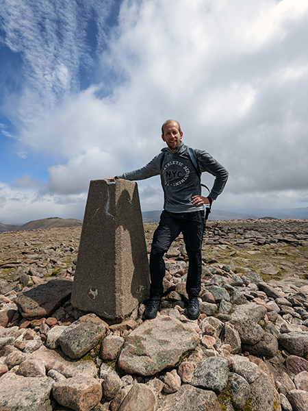
The path along the valley and up the first few mini-peaks is as clear as a road, but once you hit the rocky fields towards the top it's easy to lose it - we ended up traversing the Southern slope towards the peak, as opposed to following the ridge line straight up and then across the escarpment.
That said, our route was probably less strenuous than the direct approach, and presented fantsatic views of the munros and valleys to the West and South!
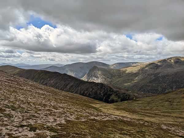
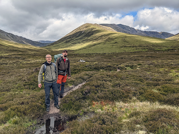
Once you reach the escarpment, it's pretty much a straight shot West to the summit, which is marked by a Cairn and the remains of several bothy's, but is otherwise unremarkable.
When doing the hike from the Linn of Dee, there is an option to complete Derry Cairngorm on a circular route - due to the wind, we very quickly agreed this was not worth it, and headed straight back down, spending a second night in the bothy before heading home on Sunday.

There is also an option to challenge the mountain from the Lecht Ski Center - this is a long, but less strenuous hike.
I will add one final note about Bob Scott's bothy - it's fantastic! If you're lucky enough to get there with space to spare, it's a great overnighter if you'd prefer not to camp. Halfway up the valley, right next to the river, it's very well maintained, with a fireplace and some basic kitchen items. You also get to meet some very interesting folk!
You can read more detail on the route, and download Offline maps on the Walkhighlands website.
Munros: Bidein a Ghlas Thuill / Sgurr Fion
Height: 1062 meters / 1060 meters
Date: 21/08/2021
There are many words to describe An Teallach as a mountain, but I'm not sure any of them actually do it quite the justice it deserves. I'm thinking "Hulking", "Dominating" & "Scary" are probably most apt, though "Stunning", "Dramatic" & "Awe-inspiring" are also just as true.
It is, without doubt, the most beautiful and impressive of the Scottish Munro's that I have climbed to date.

An Teallach starts at sea level, and climbs to an impressive 1062 meters - unlike most other Munro's that start well above sea level, you have to climb the full altitude if you want to conquer it!
Unsurprisingly then, the 16 kilometers (shortest Up and down route) will take you approximately 7 hours. If you choose to do the traverse, going down the South end of the mountain and back around the base, that can take up to 11.
There are multiple possible routes to consider when heading up An Teallach, not just the one highlighted on Walkhighlands - we accidentally ended up following the valley below (to the South of) the main ridge path, following a small river to the bottom of the final ascent - while the path was not very clear, it's a much easier ascent, and affords great views to the East.
The final section to the first peak (Bidein a Ghlas Thuill) is very steep, and again the path is not very clear. Once up, you have to descend 170 meters, and then go up that distance again to hit Sgurr Fiona.
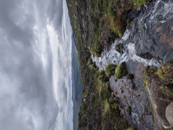
At this point you can either continue further South, traversing the ridge and finding your own way down to the Southern Valley, then walking all around the base of the mountain to the Carpark. Alternatively, turn around and go back the way you came, which is much shorter, but you have to climb the first peak again!
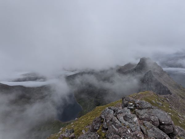
The views from the top are unparalleled - even in cloudy weather (like we had), breaks in the cloud cover give glimpses as to how dramatic and steep the rock faces and peaks are all along the ridge to the South.
All in all, this is a great hike on an awesome mountain - and it's the first Munro I've done that I think I'd really like to do again!
You can read more detail on the route, and download Offline maps on the Walkhighlands website.
Munros: Schiehallion
Height: 1083 meters
Date: 19/06/2021
This was a case of third time lucky, with what is arguably my favorite munro! I'd previously tried to complete Schiehallion back in 2000, and then again in 2017, both times unsuccessfully (due to bad weather). This time though, nothing was going to stop me!
In fairness, this is not a difficult munro by any means. It is quite unique however, in that it's just "there"; by itself, in the middle of nowhere, not connected to or anywhere near any other mountain of note.
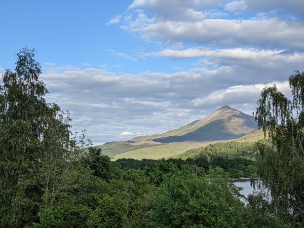
When viewed from the North-West (Kinloch Rannoch), it's quite conical, though when driving in from the East you can see a long ridge heading down from the peak to the South-East. The parking is easily accessible by road, though it's a fairly long drive from anywhere that counts as civilization to get to the parking lot at the start of the climb. In the past, the parking used to overflow all up and down the road, due to limited availability, though this is now no longer permitted, and a second parking has been developed further up the road.
The climb heads up from the South East - starting at 330m, it's initially a very gentle climb, though it gets progressively steeper as you head higher up to the final altitude of 1083m.
The path itself takes you along a broad ridge, and is clear and well-trodden until you come upon the boulder field - after that, it's pretty much make your own way, as long as you keep heading up, up and up. Being a very exposed mountain, the wind can be a nuisance - both previous attempts I made were cut short by the wind - it's not very pleasant when it's blowing a gale up there!
Myself, Hallur, Lukasz & Lukasz started the climb late on a Saturday, as the main activity of a weekend-long camping trip at Loch Rannoch (which was a complete Midge-fest, by the way!). We made it up and down in a little under 4 hours, with Lukasz complaining all the way up about how old and unfit he was. Not much complaining from him on the way down though!
Unfortunately the visibility from about 500m and up was near-zero on the day we climbed, though on a clear day from the top the views in all directions are breathtaking!
Schiehallion is a very interesting mountain in its geology and history. It is sometimes called the "Upside-down" mountain, due to the fact that the rocks at the top are actually older than the ones at the bottom!
It was also used in 1774 during an experiment to measure the mass of the Earth. An excerpt from Scottish Geology explains:
"The experiment of 1774 to weigh the Earth involved measuring the deflection of a plumb line resulting from the gravitational pull of a nearby mountain. Schiehallion was considered the ideal mountain, due to its isolation and almost symmetrical shape. The tiny deflection of a plumb-line from the vertical must be measured relative to the fixed background of the stars, which requires extremely careful measurements on either side of the mountain. The mass of the mountain can be worked out from its volume and the density of its rocks. These values can be used to find the gravitational pull of the Earth, and thus its mass."
Most interesting!
You can read more detail on the route, and download Offline maps on the Walkhighlands website.
Munros: Carn an Tuirc / Cairn of Claise / Glas Maol / Creag Leacach
Height: 1019 meters / 1064 meters / 1068 meters / 987 meters
Date: 26/09/2020
Completing the Glas Maol circuit was not mine and Asia's original plan for the day, but due to a miscalculation in the driving distance on the day we were aiming to conquer Ben macdui & Cairn Gorm, we ended up choosing this route while on the road out of Aberdeen.
This definitely isn't a route we'd select over other Munro's - in fairness, outside of the intial climb up Carn an Tuirc, it's a very easy walk; from the first peak, it's a case of crossing a long escarpment over the next two peaks, none of which are particularly challenging.
The views are ok along this stretch of the route, but the top of the escarpment itself is quite flat and featureless.
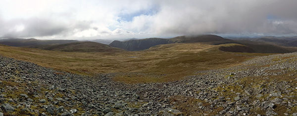
Creag Leacach provides a welcome break from the monotony of the previous 3 peaks, with a fair bit of clambering up the rocky sides to hit the peak.
The route is not very well marked, and actually seems to disappear at certain points. Having a map (or using the Walkhighlands routefinder) is highly recommended for this route, especially when it's not clear.
Which brings me to the weather. As always, the weather in the highlands is ever changing, and we had it pretty rough on our hike. A strong wind, heavy mist and a stinging, sleety rain accompanied us most of the way up Carn an Tuirc. Once we hit the top the rain eased off, but the wind got progressively worse as we continued.
Creag Leacach was horrendous, if I'm honest. It's a completely exposed peak, and the wind comes up from the valley to the West, gathering pace and power as it's forced up the mountainside. By the time it hit us, trying to cross the ridge from Glas Maol, it was hurricane force, and we had to stop several times trying to find shelter and get our breath back.
To top it off, I'd hurt my knee half way up, and trying to fight for balance against the wind only exascerbated the injury.
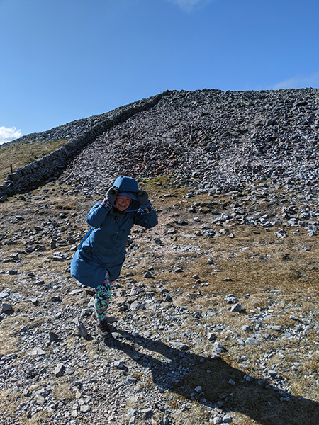
The way down was torturous, as we had to fight INTO the wind all the way down to the road by the Glenshee ski center. I couldn't walk any further once we hit the road; Luckily Asia was prepared to go fetch the car (2 1/2 km up the road) while I rested up in the Cafe. Thanks Love, lifesaver!
All in all, I'm glad we completed another four Munro's, but I wouldn't be interested in doing any of these again.
You can read more detail on the route, and download Offline maps on the Walkhighlands website.
Munros: Beinn Ghlas / Ben Lawers
Height: 1103 meters / 1214 meters
Date: 22/08/2020
Ben Lawyers, the 10th highest munro, is the Munro that everyone targets when they're doing this route, but as it turns out, Beinn Ghlas is actually a much harder climb!
The route to Ben Lawyers takes you over Beinn Ghlas, and it is one of the Lawers 7 (A route starting from the Lawers Car park on Loch Tay, and ending at the National Trust car park,about 6 miles down the road).
As a result, a lot of people don't even realise they've summited Beinn Ghlas; It's marked by only a small cairn of stones at it's peak. This, I feel, is incredibly unfair on what is a really tough climb, and a worthy mountain to have conquered.
The route I took was from the National Trust Car Park; the first 45 minutes or so are quite gentle, meandering alongside a burbling river with some small rapids.
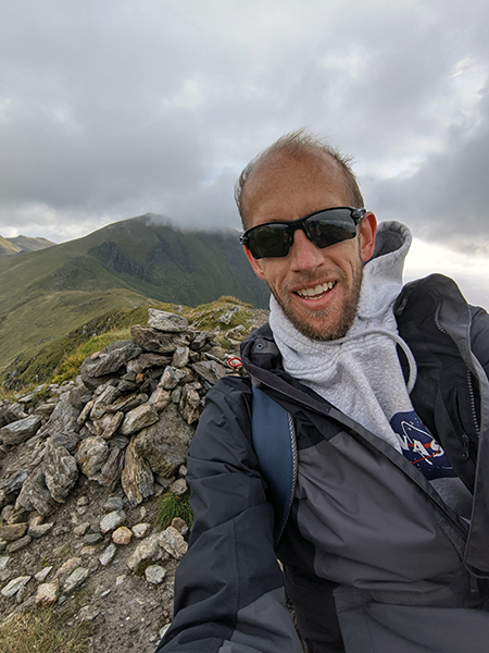
Once you hit the slope of Beinn Ghlas though, it turns into a beast. It's quite steep all the way up to the first ridge - once you hit that you get about 5 minutes respite before going up and up and up again, until you hit the peak.
I rate myself as quite fit, but I had to stop several times along this stretch to get my breath (and take in the views, as a I kept telling myself :p)

As I said earlier, once you've conquered Beinn Ghlas, Ben Lawers is pretty simple - the route winds down across a saddle, and then sharply up to the peak of Ben Lawers, but only for about 15 minutes. Before you know it, you've reached the top.
The views from the top are breathtaking, South along Loch Tay; North, East & West just valleys and more Munro's as far as the eye can see.
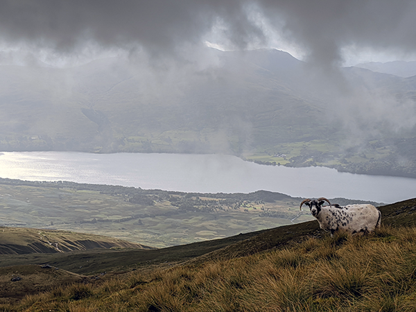
Word of warning (as always, it seems!) - it can get crazily windy up top of Ben Lawers - I almost got blown down the East face while trying desperately to take a quick picture. There's not much opportunity to hang around on top admiring the view in those conditions!
The way back down, if you take the Northern, alternate route, is very gentle, and curves around Beinn Ghlas, meeting the original trail just at the start of the main ascent. It's worth considering this as a route up Ben Lawers, if you're looking to avoid Beinn Ghlas, but why would you ever want to miss out on completing a double munro just because it's a little bit tough?!
All in all, while this is a very tough climb, it's also pretty short - I made it up and down in a little over 3 hours.
You can read more detail on the route, and download Offline maps on the Walkhighlands website.
Munros: Ben Lomond
Height: 974 meters
Date: 01/08/2020
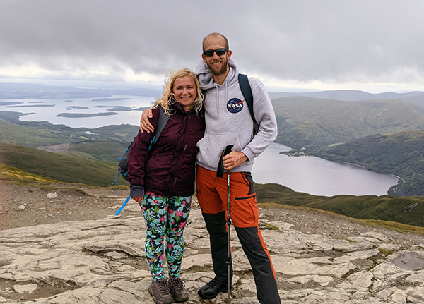
Ben Lomond is the first (hopefully of many) Munro's that I climbed with Asia. It's a fabulous mountain, dominating the West bank of the beautiful Loch Lomond. It's the most popular Munro in Scotland, with up to 30,000 hikers ascending it every year - which leads me to a early word of warning - DO NOT PARK ON THE ROADSIDE!
On the day we climbed, the road 2 miles south of the car park was jammed with cars parked up and down the way. We were patient and lucky, and managed to find a spot in the car park. On the way back out, every single car along the road had a fixed notice penalty stuck to their windscreens.
Ben Lomond's popularity becomes evident as soon as you start the climb - most hikers ascend using the South-Easterly route, winding through the forest before heading pretty steadily up the Southern ridge to the peak. Most hikers then use THE SAME route down.
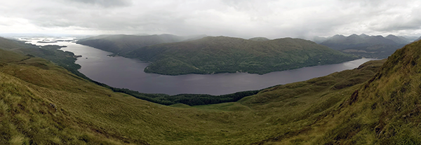
What results, especially when the weather is fine and COVID-19 is in the air, is lots of stopping and waiting for people to go past you... the circular route down going over the Ptarmignon is much more daunting, especially when you're on the peak looking down the rocky, winding path, but it is most definitely worth the effort - while the path down is steep and hard on the knees and toes, the views looking North, West & South down Loch Lomond are breathtaking.
The view from the top itself is something to behold - looking North, it's row upon row upon row of mountain peaks - most of them look to be Munro's as well. To the west lies Loch Lomond, with yet more mountains lining up behind it, while to the East it's more rolling hills and valleys. Quite breathtaking!
We completed the hike in a little over 4 1/2 hours, though the average time is between 4 1/2 to 5 1/2 hours. It's been labelled as a "beginner's" Munro, though I feel that's a little unfair - If you were to take the popular route up and down, you'd probably find it quite tiring, but not overly so.
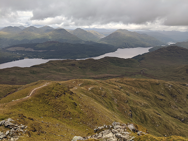
Bear in mind that the start point is not that high above sea-level, so you're actually ascending almost a kilometer. Add the descent along the circular route to the mix, and it's actually a much more challenging mountain, easily as challenging as any other Munro I've climbed (well, of the two others I've climbed to date!).
Being quite close to Glasgow, it's one of the easier Munro's to access, and if you only have a short time in Scotland, but still want to bag a Munro, this is as good a mountain as any. As with any Munro in Scotland, be prepared for 4 seasons in one day - we had really good weather on the day we climbed - mostly cloudy, some short showers, and some sunshine later on - but some of the hikers ahead of us got caught up on the peak in a proper shower.
You can read more detail on the route, and download Offline maps on the Walkhighlands website.
Munros: Carn a' Mhaim
Height: 1037 meters
Date: 02/03/2020
Carn a' Mhaim (Carn a Vame), in the Central Cairngorm range, doesn't look all that high as you're approaching it from the East. In fairness, it's not actually that high; coming in at 1037 meters, it's the 95th highest Munro in Scotland.
Climbing it in the Summer would probably be pretty simple. You might see what is undoubtedly a spectacular view from the top. You could even tackle Ben Macdui as a second peak if you had decent weather and a full day.
We had none of the above though.
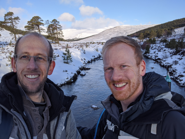
We climbed it in early March. Heading along Glen Lui, we had a pretty good view of the snow covered peak once we'd passed Bob's Bothy, but this disappeared as soon as we hit the base of the mountain. The clouds came down, the weather turned ugly, and the last 2-3 hours up and down was a complete white-out. I won't lie, the last hour or so before hitting the peak was not fun.
The snow was knee-deep when we broke through the crust, the wind was bitterly cold, and the whiteness surrounded us in every direction. It's incredibly disconcerting not being able to discern the boundary between mountain and sky, where your only reference points are the rock you're currently aiming at, and the dark of your shoes as you trudge centimeter by centimeter further up the mountain. Without Hallur's Garmin watch, I doubt we would have found our way up.
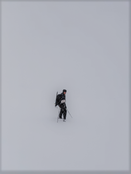
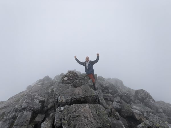
We did eventually reach the summit though, and spent a whole of 2 minutes up top; just long enough to take a couple of pictures; evidence, more than anything else, that we'd reached the summit. There was absolutely nothing to see from the top, besides more of the white we'd by now become slightly accustomed to, and it was obvious by then that we'd never make a second peak, even if we'd wanted to.
So we headed down. Much more quickly than we headed up, happily. The mountain was so steep, and the snow so hard, that i actually managed to sledge down on my backside for about 100 meters of the way. Most fun I had all day! An hour later we returned to Bob's Bothy to warm up and change into some slightly drier clothes, and then trudged back to the welcome comfort of heated seats in Hallur's car.
Taking all of the above into account, I must still say it was a great day, and a great experience. Carn a' Mhaim is definitely a mountain worth climbing, though I wouldn't suggest doing it in Winter! If you are going to climb in Winter though, please make sure that you're well prepared. There is no such thing as bad weather, only unsuitable clothing. And in the Winter, in the mountains, not being well prepared can get you killed.
The walk up Carn a'Mhaim leaves from the Linn of Dee car park, about 15 minutes North of Braemar. The first hour or so takes you further North up Glen Lui, until you reach Bob's Bothy. This is a free-to-stay shelter, that can house up to 10 folk, and is pretty cheery and warm inside. Once passed the bothy, take a sharp left over the wooden footbridge, and follow the river all along the (still pretty flat) valley until you hit the second footbridge. From here, the climb begins in earnest. The last couple of kilometers takes you up almost 600 meters, straight up the Southern slope of Carn a'Mhaim.
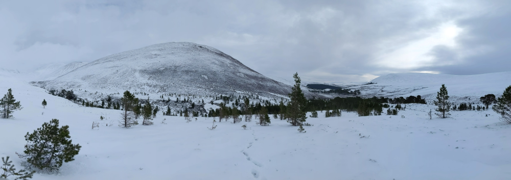
You'll need to navigate a couple of large boulder fields, and be sure not to head straight up to the highest visible point, as it's a false summit. Instead, keep West of it, and as you reach the top of the saddle, you'll see the true peak hiding behind. From here, it's much easier going, with only a gentle incline to the cairn marking the summit. Back down is via the same route.
You can read more detail on the route, and download Offline maps on the Walkhighlands website.
Munros: Lochnagar
Height: 1155 meters
Date: 15/06/2019
This is a great mountain. not sure how to say it any more enthusiastically, but I’ll give it a bash anyway... It’s the first Munro I ever completed (I’ve come close on Schiehallion a couple of times), and I don’t think I could have chosen a more dramatic option if I’d tried.
The decision to climb it was pretty last minute, but as it’s only an hour and 20 minutes drive from Aberdeen, it wasn’t too hard a choice to make in the end.
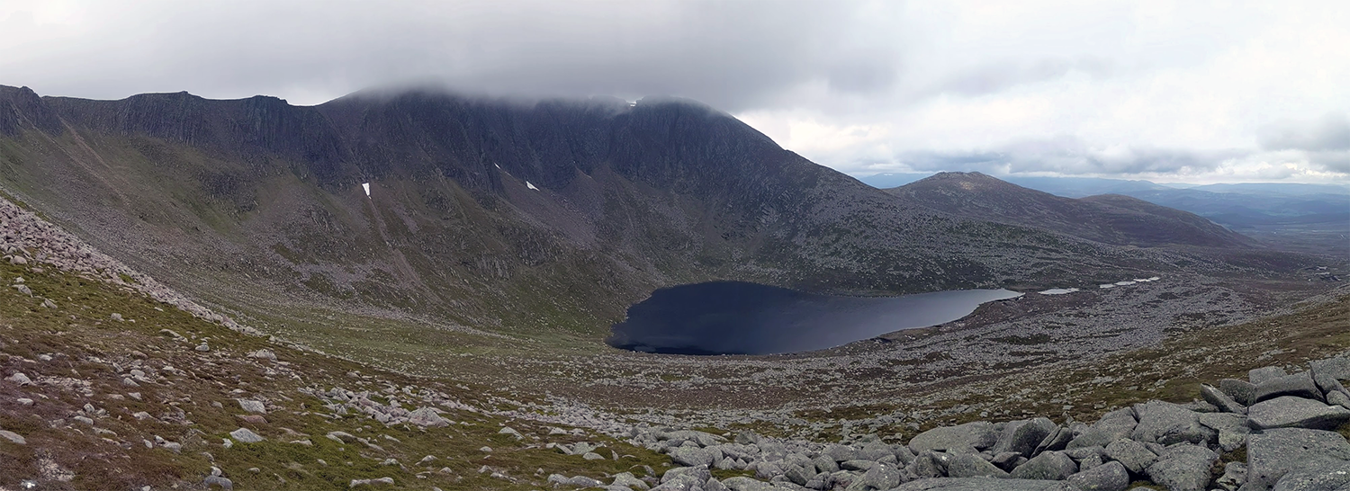
The hike starts at Spittle of Glen Muick Car Park, about 15 minutes East of Ballater, which is also the start point for walks along Loch Muick – a great alternative option if you’re not interested in climbing a mountain!
The first kilometre or so is pretty easy going, along a well worn wide path, through a lush valley and then an old pine forest. Once you’e passed through the forest it gets progressively tougher, becoming a pretty laborious uphill slog at times, broken up only by the occasional downhill respite.
The route is well worn and easily followed until you round Meikle Pap (978m), at which point you get your first real view of Lochnagar itself, in all its glory. its ragged, rugged, dramatic and beautiful, though a little bit daunting!
You now start heading up Cuidhe Crom (1082) – here the path turns into a boulder field, and it’s easy to lose the path while ascending – I did several times, and only really found it again as I neared the lower peak. The views up till now are stunning, but once you gain the higher reaches they really become breathtaking.
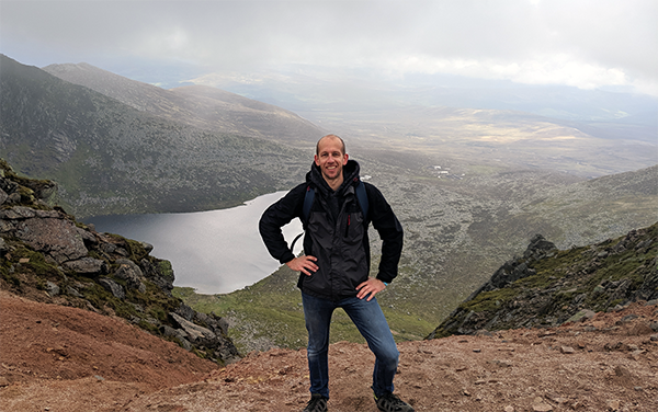
The day I climbed was pretty cloudy, and I hit the clouds when I reached the ridge leading along Lochnagar; the visibility turned to pretty much zero, and the temperature plummeted. If you’re walking along here by yourself, with no-one else in sight, it’s easy to imagine how hikers become lost – it’s pretty disorienting. Happily there are cairns built at 10-20 meter intervals along the route, so even in the thickest pea-soup mist, it’s possible to keep going.
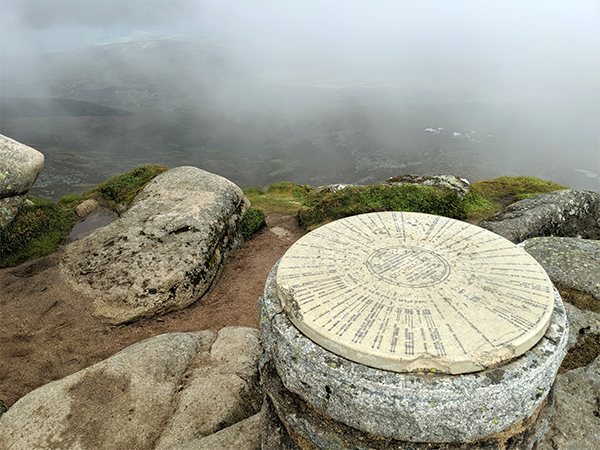
The last stretch of the hike is pretty easy going again, up till the peak itself. On a clear day you could probably see China, but I settled for the satisfaction of just having succeeded...
There is a roundabout route for the way back to the car park, which takes walkers past the Falls of the Glasallt and along Loch Muick – I chose to head back down the way I came up – a bit shorter, and I didn’t have it in me to go any further than I absolutely had to!
All in all, it’s a great climb – I probably pushed myself a bit hard on the route, completing the climb and descent in little over 4 hours. If I had to do it again, I’d take my time and complete a couple of the smaller peaks on the way.
You can read more detail on the route, and download Offline maps on the Walkhighlands website.